Contour lines online, from terrain model to DXF
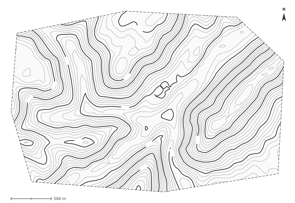
Draw an area on the map: almawqii builds the digital terrain model from SRTM satellite elevation or your own surveyed points, traces the contour lines at the interval you choose and exports them to DXF, each order on its own layer, for AutoCAD, COVADIS or MawCAD.
- Interval from 1 cm to 1,000 m
- Index contours
- DTM · TIN
- Smoothing · splines
- DXF · SHP · KML · GeoJSON · CSV
- Computed in your browser; only your projects are saved, in your account.
- Free with an account: 3 projects saved automatically
Draw contour lines in 5 steps
Allow a minute for a parcel: the time it takes to load the relief.
-
1
Open Carte and sign in
Contour lines, the terrain model, layers, import and export are member tools: a free account is enough.
-
2
Outline the area
Draw a polygon around the site, or import your survey (DXF, CSV or TXT X Y Z, KML, GeoJSON, Shapefile): points that carry an elevation feed the terrain model.
-
3
Choose the interval
In the polygon’s popup, “Contour lines” opens the terrain dialog: pick a step set (0.25/1 m, 1/5 m, 2/10 m…) or set up to five orders one by one — step, layer, colour, linetype, width.
-
4
Fine-tune the drawing
Simple polylines, smoothed polylines or splines; internal or B-spline smoothing; simplification, elevation filter and elevation source: SRTM, SRTM corrected by your points, or your points alone. The preview follows every setting.
-
5
Export, or move to MawCAD
The DXF (AutoCAD 2000) puts each order on its own layer — CN_01_00, CN_02_50… by default, as in COVADIS — and the terrain model as 3D faces on MNT_TN; GeoJSON, KML, Shapefile and CSV follow. “Open in MawCAD” takes every object across on its layer.
What the tool does
Triangulated terrain model
A Delaunay TIN on a 4,900-node grid by default (up to 10,000), with an automatic or chosen spacing and a satellite noise filter.
Any interval
From 1 cm to 1,000 m, up to five contour orders; on first opening, an automatic step suited to the relief.
Index contours
Thicker, on their own layer, with their colour and linetype; a level shared by two orders always goes to the larger step.
Smoothing
Simple polylines, smoothed polylines (internal or B-spline, 2 to 32 points per segment) or true splines in the DXF.
Your surveyed points
SRTM alone, SRTM corrected by your points (GNSS, total station) or your points alone: the terrain model honours the measured elevations.
Layers all the way to MawCAD
Every point, line, parcel, contour and terrain model has its layer, kept as is in the DXF and in MawCAD: long profiles, cross sections, cut and fill.
How accurate is it?
Without surveyed points, elevations come from the SRTM model, about 30 m on the ground. The mission specified an absolute vertical error under 16 m in 90 % of cases; on open ground it is often a few metres. SRTM measures the surface — roofs, dense canopy — and not always the ground. That is enough for a preliminary study, an outline design or a reconnaissance, not for a topographic survey plan.
For a survey plan, import your points (GNSS RTK, total station). In “surveyed points only” mode the terrain model is triangulated on your measurements and honours every elevation; in mixed mode your points correct the satellite around them. Match the interval to the data: with SRTM alone, rarely under 2 to 5 m, or the lines draw the model’s noise rather than the ground.
Which interval for which scale?
The usual values — the step sets the dialog offers, one index contour every 4 or 5 lines.
| Plan scale | Interval | Index contours | Typical use |
|---|---|---|---|
| 1:200 | 0.25 m | 1 m | As-built plan, site utilities |
| 1:500 | 0.5 m | 2.5 m | Parcel survey, setting out |
| 1:1,000 | 1 m | 5 m | Subdivision, site plan |
| 1:2,000 | 2 m | 10 m | Preliminary road and drainage design |
| 1:5,000 | 5 m | 25 m | Site study, catchment |
| 1:25,000 | 10 m | 50 m | Topographic map, reconnaissance |
Contour lines: common questions
How do I make contour lines online for free?
Open Carte, sign in (the account is free), draw a polygon and choose “Contour lines”. almawqii loads the SRTM relief, computes the terrain model in your browser and traces the lines; export to DXF, KML, GeoJSON, Shapefile or CSV is free as well.
Which contour interval should I choose?
At 1:500, 0.5 m; at 1:1,000, 1 m; at 1:2,000, 2 m; at 1:5,000, 5 m; at 1:25,000, 10 m — with an index contour every 4 or 5 lines. With satellite elevation alone, stay at 2–5 m or more: below that, the lines draw the model’s noise, not the ground.
How accurate are satellite contour lines?
The SRTM model has a resolution of about 30 m; its absolute vertical error was specified under 16 m in 90 % of cases and is often a few metres on open ground. It measures the surface (roofs, trees). For a topographic plan, use your surveyed points: the terrain model then honours every measured elevation.
Can I use my own survey points?
Yes. Import them (CSV or TXT X Y Z, DXF, KML, GeoJSON, Shapefile) or draw them, then choose “surveyed points only” or “satellite corrected by surveyed points” as the source in the terrain dialog. The terrain model goes through your elevations.
How do I open the contour lines in AutoCAD or COVADIS?
Export to DXF: the file, in AutoCAD 2000 format, puts each contour order on its own layer (CN_…), with its colour and linetype; splines stay splines and the terrain model goes out as 3D faces (3DFACE) on MNT_TN. It opens in AutoCAD and DXF-compatible software such as BricsCAD, ZWCAD or QGIS.
What is a digital terrain model?
A continuous surface of elevations. Here it is a TIN: a network of Delaunay triangles whose every vertex carries an elevation. Contour lines are where that surface meets horizontal planes spaced by the interval. You can keep the terrain model on its own layer and export it.
Do I need an account?
Yes for contour lines, the terrain model, layers, import, export and MawCAD: a free account, verified by email, which also keeps 3 projects saved automatically. Without one, the map, drawing, measuring, projections and the converter stay free, but nothing is kept.
Which regions are covered?
SRTM relief covers the Earth between 60° N and 56° S, so all of Morocco, Algeria, Tunisia and France. Coordinates come out in those countries’ national Lambert grids or in UTM 28 to 32 N.
Your contour lines in DXF within two minutes
A free account, a polygon, an interval: the rest is computed in your browser.